Reports
Post Script: Looking at the new construction activity near Natanz from a new perspective
November 5, 2020
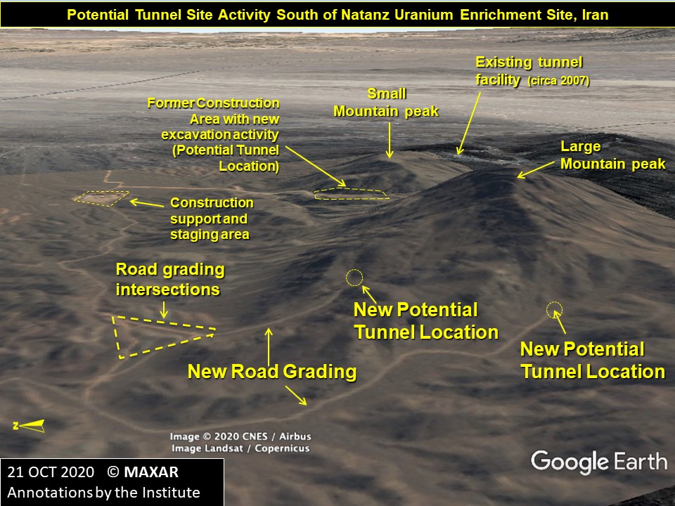
On October 30, 2020, the Institute released a report, “Update on New Construction Activity at Natanz,” which briefly discussed new road grading activity to the west of the staging area for the new centrifuge assembly facility. The new road grading activity appears to be road intersections between two graded roads leading to the base of a large mountain. This was determined by overlaying the latest MAXAR image dated October 21, 2020, onto Google Earth. Rotating the overlay to see the terrain view (looking east) from a new perspective, shows clearly that the two graded roads from that intersection eventually dead end at the base of the larger of the two mountain peaks (See Figure below). This at least suggests that these should now be labeled as two new potential tunnel entrance locations.

Figure. An overlay of the October 21, 2020, satellite image on a Google Earth perspective view reveals two new potential tunnel locations.
Click below do download the kmz files for the potential tunnel entrances:

 twitter