Solving the North Korean Nuclear Puzzle: Chapter 3, Fig. 2-3
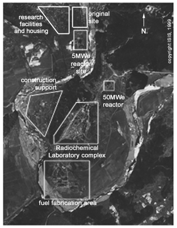
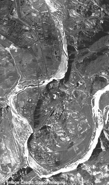
Figure III.2 (top) and Figure III.3 (bottom) The picture above is an overview of the Yongbyon nuclear site as it appeared in January 1989 on a Russian KVR-1000 image. This image is annotated to show the main areas of the site. The bottom picture, courtesy of Space Imaging, shows the site in early 2000.
Clearly visible in both pictures is the Kuryong River running through and around the site. The older buildings, the IRT reactor, the Isotope Production Laboratory, and the Institute of Radiochemistry are shown in the upper portion of these photographs. The 5 megawatts-electric (MWe) reactor and associated buildings are in an area just south of the oldest part of the center. To the west of these areas are research and housing facilities. Travelling east across the bridge that runs between the oldest part of the site and the 5 MWe reactor, and then going south through a tunnel, one comes to the 50 MWe reactor. Continuing down the road past this reactor, the reprocessing plant, or "Radiochemical Laboratory complex," is visible. Continuing along the road, past the reprocessing complex and turning south at the "T"-junction one passes the fuel- fabrication complex. Turning north at the "T"-junction, one comes to a construction support area.
‹ Back