Reports
Iran’s Investigation of Possible Underground Nuclear Test Sites in the AMAD Program prior to 2004
by Institute for Science and International Security
May 1, 2018
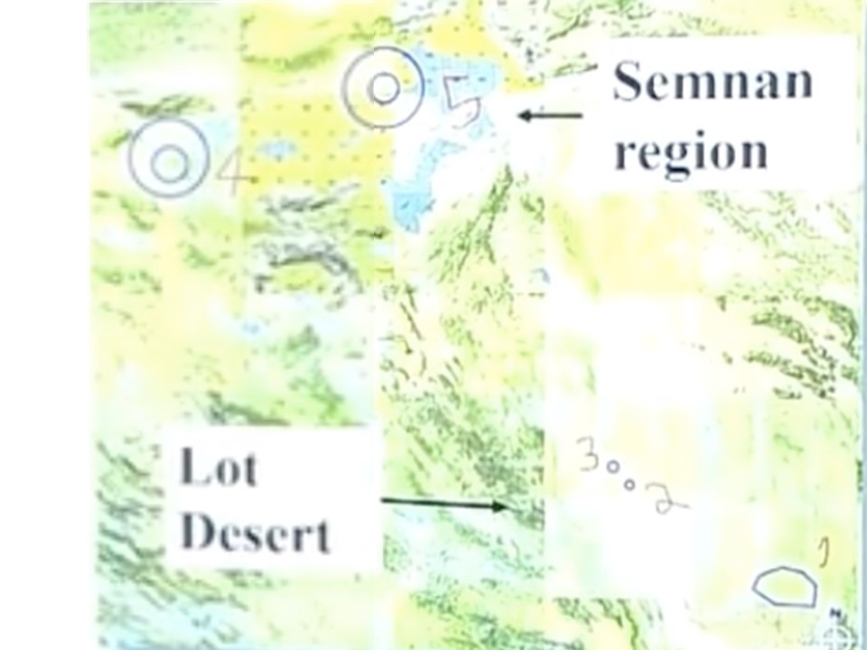
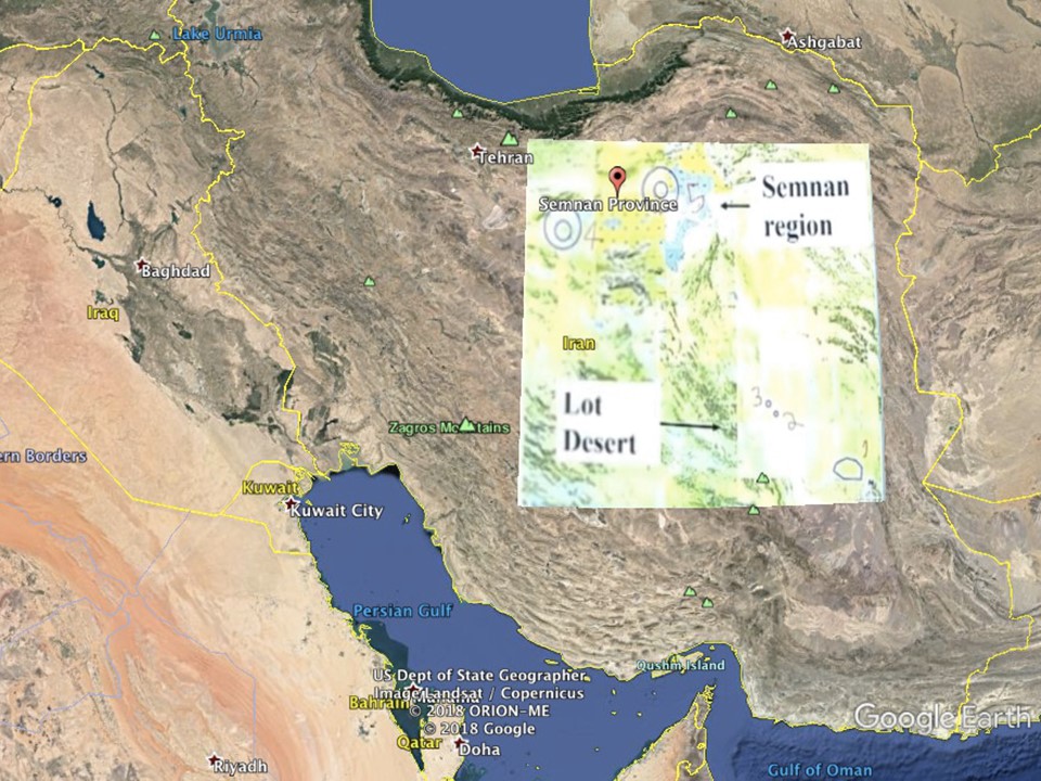
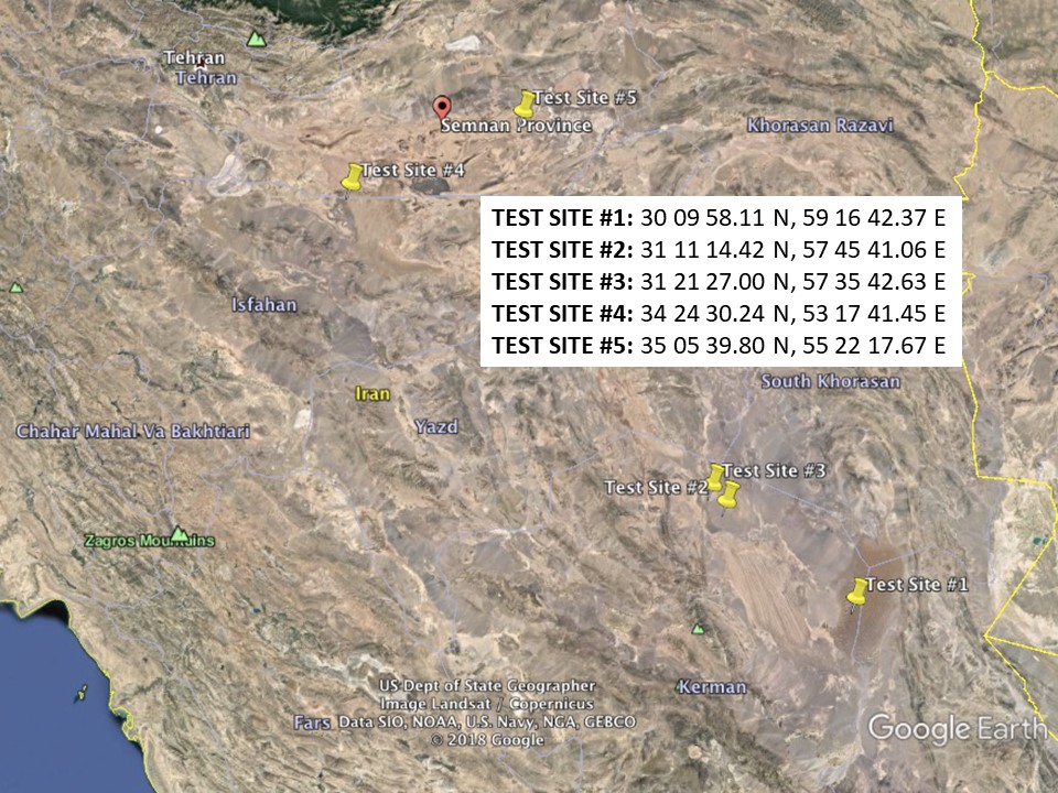
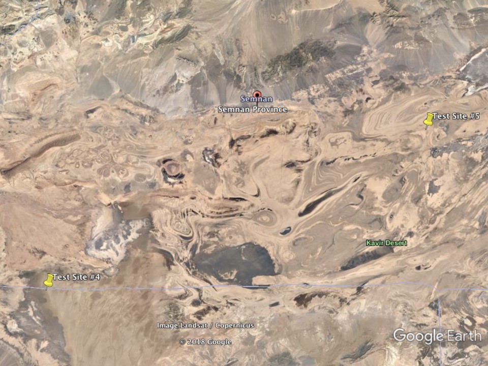
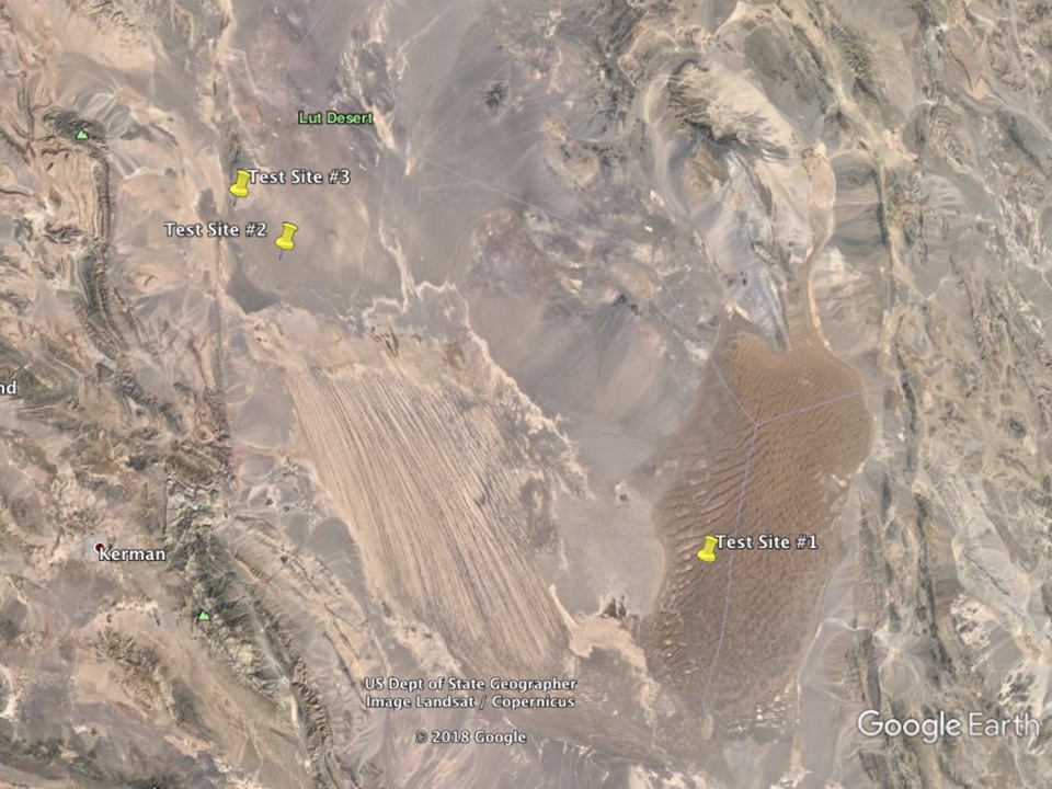
The following figures reveal possible locations Iran investigated as potential nuclear test sites prior to 2004. Figure 1 shows a map with the marked test sites, which was overlaid on Google Earth (figure 2). This revealed the following locations and coordinates (see figure 3):
TEST SITE #1: 30 09 58.11 N, 59 16 42.37 E
TEST SITE #2: 31 11 14.42 N, 57 45 41.06 E
TEST SITE #3: 31 21 27.00 N, 57 35 42.63 E
TEST SITE #4: 34 24 30.24 N, 53 17 41.45 E
TEST SITE #5: 35 05 39.80 N, 55 22 17.67 E
Figures 4 and 5 provide close-ups of the sites.
Images
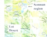
Figure 1.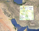
Figure 2.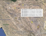
Figure 3.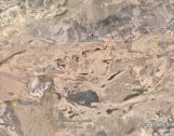
Figure 4.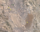
Figure 5.
 email us
 twitter