Reports
Satellite Imagery Narrows Qom Enrichment Facility Construction Start Date
by Paul Brannan
November 5, 2009
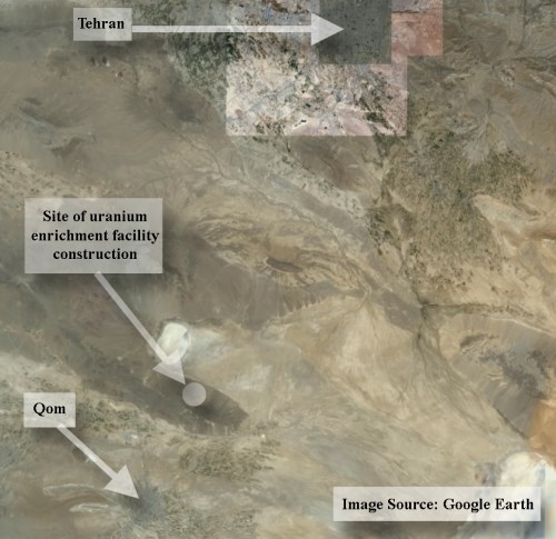
ISIS has obtained commercial satellite imagery from DigitalGlobe that narrows the time frame during which Iran would have begun construction of the gas centrifuge uranium enrichment plant near Qom (see figure 1). The satellite imagery indicates that Iran began construction of the enrichment facility after January 2006 but before June 2007. This time frame is consistent with a Reuters report that construction began in 2006.
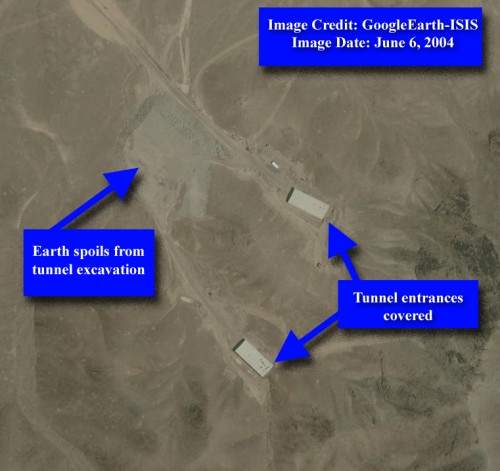
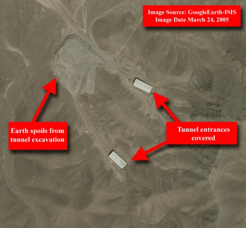
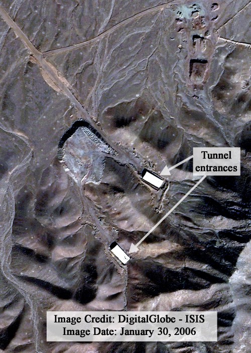
ISIS previously assessed that the June 2004 and March 2005 satellite imagery seen on GoogleEarth depict the future site of the enrichment plant construction, but at the time show tunnel entrances that were likely not yet associated with the uranium enrichment construction project (see figures 2 and 3). The Atomic Energy Organization of Iran could have chosen among existing tunnel facilities throughout the country, and settled on this one near Qom, to site the covert enrichment plant. The January 2006 DigitalGlobe image of the site is very similar to the 2004 and 2005 imagery (see figure 4), which indicates that construction of the uranium enrichment plant had still not yet commenced as of that date.
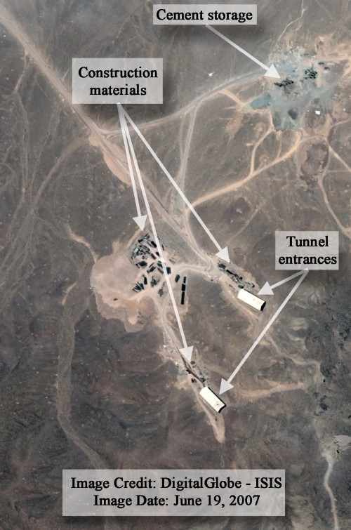
The June 2007 image shows notable differences from the three previous images (see figure 5). A large amount of construction materials is visible next to the two tunnel entrances and at one of the adjacent construction staging areas, and possible cement storage is visible at another nearby construction staging area. ISIS assesses that construction associated with the covert gas centrifuge uranium enrichment facility had begun by this June 2007 image and that the construction materials seen in the image were then used in the transformation from what was likely a smaller tunnel facility into a much larger industrial facility, the gas centrifuge hall, built inside the mountain.
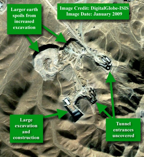
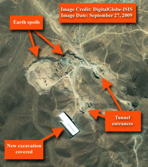
The January 2009 image shows a large amount of construction and excavation activity (see figure 6), and the September 27, 2009 still shows a large amount of construction activity (see figure 7), though the tunnel entrances and another excavation have been covered.
A February 2000 image from GeoEye shows that the initial tunnel entrances were not yet present at that date (see figure 8).
(Suspect_Site)(IKONOS)(5FEB2000)_copy.jpg)
 email us
 twitter